Maps
War Years Resources Maps
Map of Loudoun County and part of Clarke County, Va., Jefferson County and part of Berkeley County, W. Va., and parts of Montgomery and Frederick counties, Md
1864 (Library of Congress)
War Years Resources Maps
Part of Carroll County, Maryland
J. N. Macomb, 1862 (Library of Congress)
War Years Resources Maps
Part of Washington County, Md
Bureau of Topographical Engineers, 1862 (Library of Congress)
War Years Resources Maps
Map of the vicinity of Hagerstown, Funkstown, Williamsport, and Falling Waters, Maryland Accompanying the report of Major General G. G. Meade, on the battle of Gettysburg, dated October 1st 1863
United States. Army. Corps of Engineers. Published by authority of the Hon. the Secretary of War. Office of the Chief of Engineers, U.S. Army, 1879. (Library of Congress)
War Years Resources Maps
Martenet and Bond’s map of Montgomery County, Maryland
From actual surveys by S.J. Martenet & assistants; drawn and published by Simon J. Martenet C.E. Baltimore : Simon J. Martenet, [1865] (Baltimore : Lith. by Schmidt & Trowe) (Library of Congress)
War Years Resources Maps
Loudo(u)n County, Virginia
By Edwin Hergesheimer, 1861 (Library of Congress)
War Years Resources Maps
Harper’s Ferry (1863)
Prepared by Bvt. Brig. Genl. N. Michler, Major of Engineers, from surveys under his direction, by order of Brig. Genl. & Bvt. Maj. Genl. A. A. Humphreys, Chief of Engineers, and under the authority of the Hon. Secretary of War Surveyed & drawn by Maj: J. E. Weyss, assisted by F. Theilkuhl, J. Strasser & G. Thompson. (Library of Congress)
War Years Resources Maps
Map of Jefferson County, VA
Photographed for the Bureau of Topographical Engineers Oct. 1862, by S. Howell Brown, 1862 (Library of Congress)
War Years Resources Maps
Map of Jefferson County, VA
Photographed for the Bureau of Topographical Engineers Oct. 1862, by S. Howell Brown, 1862 (Library of Congress)
War Years Resources Maps
Military map showing the topographical features of the country adjacent to Harper’s Ferry, Va.
Including Maryland, Loudoun, and Bolivar Heights, and portions of South and Short Mountains, with the positions of the defensive works, also the junction of the Potomac & Shenandoah Rivers, and their passage through the Blue Ridge. Surveyed from August 3d to Sept. 20th 1863, under the direction of Capt. N. Michler, Corps of Engrs., U.S. Army, by Major John E. Weyss, Principal Assistant, Engineer Department, Army of the Potomac. Lettering by Wm. Hesselbach.] Engraved in the Engr. Dept. (Library of Congress)
Images
Historic Documents

War Years Resources
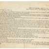
General Lee's Letter to the People of Maryland
September 8, 1862 (National Park Service)

War Years Resources
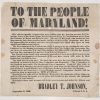
Confederate Colonel Bradley T. Johnson Message
September 6, 1860 (Perkins Library, Duke University)

